Call us - (210) 367-5843
Boundary & Subdivision Surveys
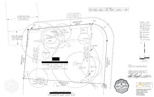
Boundary surveys are the most basic survey a land surveyor can perform - however, the information collected in a boundary survey is argualy the most important information a land surveyor can obtain. When conducting a boundary survey, a land surveyor will run the real property line, using information from the property deed and the real world property markers to guide them. In doing so, the surveyor has the ability to identify any discrepancies in the location of the physical property/boundary markers discovered in relation to the information supplied in the deed/original survey, and can set any property markers that are found to be missing or are unable to be located. This information is critical in any transfer of title, or when considering subdividing or adding improvements to a property. Running the property line also provides an opportunity for the surveyor to identify and locate any encroachments over the property line, which can be used to determine what future conflicts might occur with neighboring land owners.
>Boundary and subdivision projects.Topographic Surveys
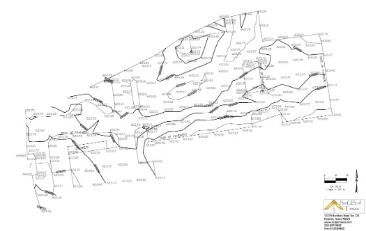
Getting a topographical survey is part of the first step in developing a property. These are 3-Dimensional maps of your property that show the current natural or man made topographic features of your property as well as the locations of any utilities, improvements or existing man-made structures. Understanding the topography of the land being developed is critical for architects and engineers as it allows them to create accurate designs that are appropriate for the conditions of the site. As an example of how the information is used, when determing where to place a building, the land developers need to understand how water drains and pools in the area. The reason for this being that they need to ensure the new structure isn't flooded when it rains as well as ensure the water drainage with the new structure has a minimal impact on the property and environment around it.
>Topographic survey projects.Construction Staking
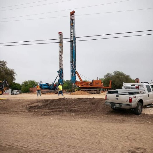
Construction staking, also called a Site Layout Survey, is used to provide a real world view of the proposed layout of a site before or during construction.
This is done to ensure a project is built according to engineering plans and helps an organization make the leap from having plans and layouts to starting
construction work. Construction staking can also allow a project manager to determine where conflicts may occur between their plans for construction and the
physical construction barriers present on site. Determining this ahead of time helps avoid lost time and money for both the construction company and the
organization funding the project, which makes construction staking a no-brainer.
There are two main varieties of construction staking to consider, the first being rough grade staking. Rough grade staking is used for understanding the
rough elevation and position of the proposed improvements in relation to the final elevation grade of the site. This is typically done prior to bringing a
grading contractor in so that the project manager can evaluate and prepare the site for the grading contractor.
The second type of construction staking is a site layout stake, which is comparatively much more comprehensive. This type of construction stake uses the
vertical and horizontal location(s) of the proposed improvements to determine their final placement, and is performed once the site preparation, such as
excavating, filling, grading, etc. has concluded. Following a site layout stake, a construction team should be able to begin construction of the proposed
improvements.
ALTA Surveys
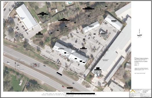
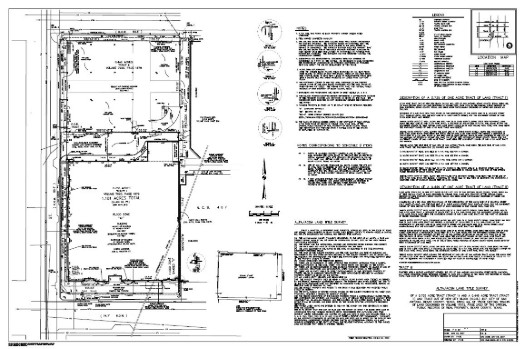
An ALTA survey is a boundary survey that is held to a set of minimum standards adopted by the American Land Title Association. Typically ALTA surveys are needed during commercial real estate transactions, vacant land purchases, or when a lender requires an ALTA survey be performed. Additionally, they are more intensive then a boundary survey as ALTA surveys have a list of specific information required for the survey that must be present in each ALTA survey. Some of the information required in an ALTA survey is information on property boundaries and easements, any improvements such as fences, roads, trails, right of ways, or other features that can affect property ownership or sale. ALTA surveys also require information be included on the properties around the target property if they affect the sale/resale of the property or the operation of an existing business or a business set to be built at the target property. You can see the ALTA standards and requirements by clicking here. Boundary surveys, at a minimum, only require information on the location of the boundaries and any encroachments over the boundary; however, they can contain additional information at the request of the client.
>ALTA and TSPS projects.Tree Location Surveys
Tree location surveys are performed both on private and public landscapes and are used to provide information on the position, species and size of trees within a designated area. This is usually done because a homeowner wants to keep specific trees for their shade or visual appeal, or because there is an existing local tree ordinance their property is subject to. Tree ordinances are set by the local governing body, be it a city or county or HOA, and they want to know how many trees will be affected by the construction, often for the purpose of enhancing or retaining a property's value by preserving certain trees. The size of the tree is measured at breast height using a tree measuring tape to determine it's diameter, and the surveyor will identify the tree type using a tree identification guide if necessary. This survey is typically combined with a topographic survey for use before development of a property begins, and is usually performed in more wooded areas as an area with a few scattered trees will likely not necessitate a tree survey.
>Tree and location projects.FEMA Flood Certificates
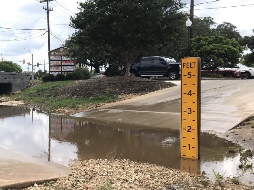
FEMA flood certificates are documents that state the flood zone status of a property. These documents get their information from a topographical survey, which collects information on the topographical features of the property, both natural and man made, as well as the geographical location of the structures or features present and the changes in elevation across the property. A FEMA flood certificate is mandatory in order to obtain certain homeowners insurance plans for homes in flood hazard areas. Depending on the area, a seller might consider obtaining a FEMA flood certificate to show to potential land purchasers before selling.
>FEMA flood certificate projects.